卑诗海平面 90年内升1米 较预估上升更快更高. ----
水患危机 !
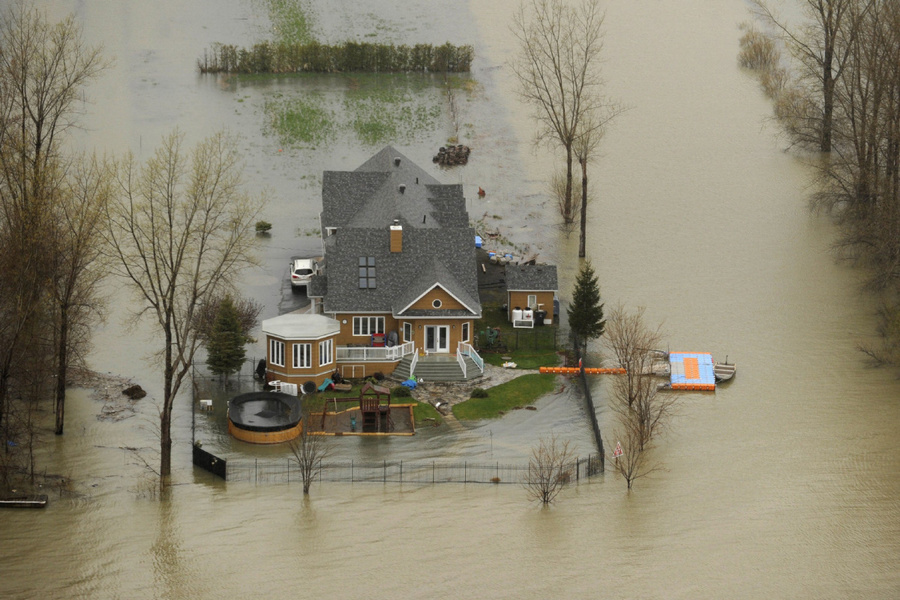
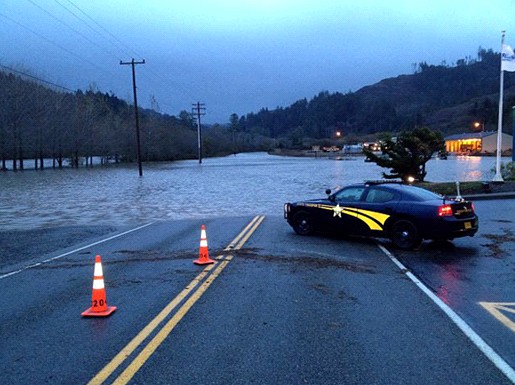
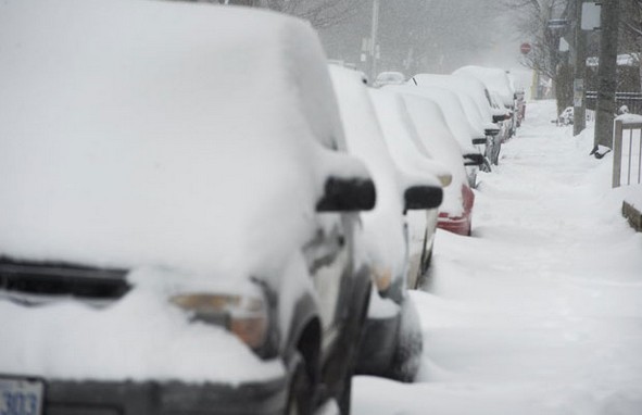
下图为 2011-5月 Canada Quebec floods 淹水的真实惨状, 木造的百万豪宅, 转眼一场空!(注意: 保险不保 水患 flooding)
{参看 新闻影片报导 1:
Quebec flood update - May 6, 2011 损失惨重 !}
{参看 新闻影片报导 2:
Quebec flood update: May 26, 2011 损失惨重 !}
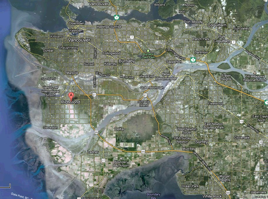
Richmond city, BC 大部份土地和海平面差不多 或更低 (比海平面低一米),, 隐患很多,置产要谨慎!
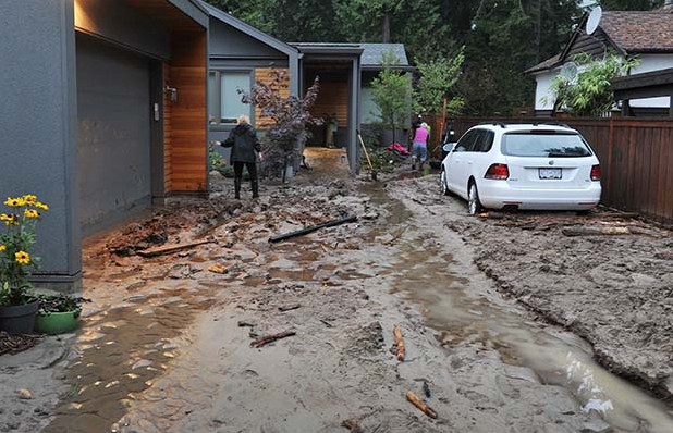
一发生海啸, 水位大量上升,您百万的房子泡在水就不值钱了,而且有身家姓命的危险. 不怕的人当然也很多(大多数人只顾眼前生活方便,很麻痹啦 !) , 5月 2011 加拿大中部及 Montreal 都相继淹大水, 住低洼区的, 可不慎哉 ? !
以下引用友 花无缺的解说
时间: 2011-3-15 15:38
************************************************
Richmond city是填土造出的,richmond是填海的沙土,任何一个地方,只要往下挖两三米,就会有水冒出来。那就是如果生生9级地震,rmd产生以下可能:
1, 土地稀松,有可能出现下陷 (天知道在填海时是不是有含糊的成分,老外做事未必就是100%的perfect)
2, 一旦发生9级大地震, Richmond(rmd)肯定被淹,是100%, 本就比海岸低了,加上地震的作用,海水必然大幅度上升(不是海
),加上土地有可能下陷的可能.. 能不被淹?!
rmd 要命的如果是地震,那好,房子倒下的可能不很大, 但Rmd真正要命的是水淹!
以上是我的人见解...
又罕见的暴风雨,会造成 停电, 水无法排出, 菲沙河水漫淹过堤岸 或
泵水站 机器运作过久而损坏不能将水抽至河道等都极可能引发大淹水 !! 久没淹大水但并不代表以后不淹.
*************************************************
(明报 2011-05-07 )一份新报告指出,气候变化加快西岸海平面的上升,幅度也比过去相信的更高,预测到2100年升高1米,增加卑诗省海岸洪涝的风险。
卑诗省政府的这份报告也警告建筑公司与开发商,应为海平面未来90年升高1米而未雨绸缪。
名为《海堤与海岸洪涝危险土地使用的气候变化适应指引》(Climate Change Adaption Guidelines for Sea Dikes and Coastal Flood Hazard Land Use)的报告预测,
海平面上升比过去所想的更快、更多。报告建议土地用途规划师,寿命最多到2050年的发展计划,设计时应考虑海平面升高0.5米,寿 命最多到2100年者要考虑海面上升1.0米。
报告又说,
海岸浪涛与暴风造成的涨水事故,其频率及强度预料不会有显着改变,对于规划者是个好消息。但应对卑诗省海岸社区所受影响,将需要跨政府的重大合作与教育。
i Ask . ca
研究报告也建议省府,更新它的海堤指引,并评估改变中的暴风雨模式。但它指出,具体的准备,大体上应由市镇政府负责,并由省府支援。作者提议,省府绘制海岸洪涝平原地图,进行一项工程研究,判断加强海岸防洪的成本。
Richmond 市政府网站-事实:
列治文市
平均在海平面之上1.0公尺; ( :通常低潮在1.0公尺以上,高潮在3.0公尺以上。即是列治文常在海水以下。
参考潮汐表。)
Lulu海岛由周围49公里的河堤保;
河堤高度高于1894年最高的洪峰,(在米逊-Mission city得7.92公尺);
39泵水站作排洪,有留作停电支援:
(26泵水站地址在此)
24小时操作子器, 察河水高度。
=> 一定要选高地住 !!
[video:: [ame="http://www.youtube.com/watch?v=WyE2LvISnC0"]参看
Quebec flood update - May 18, 2011 [/ame]]
Water levels in the Richelieu river are still rising
http://geoscape.nrcan.gc.ca/vancouver/fraser_e.php
Nature's
new ground -- delta (三角洲)
Over the last 10,000 years, a great pile of
sediment has accumulated as a delta where the Fraser River flows into the Strait of Georgia.
Can't stop GROWING -- or can it?
The Fraser delta began to develop at what is now New Westminster about 10,000 years ago and has since advanced about 25 km seaward. However, today sand is dredged to maintain the shipping channels below New Westminster, dykes straitjacket the river, and little sediment is now deposited at the front of the delta. As a result of these changes, parts of the delta front are slowly being eroded.
The Unstable Front
There have been both historic and prehistoric landslides on the submarine slope of the Fraser River delta. The delta slope could fail again if an earthquake hit the area resulting in damage to the coal port, ferry terminal, or submarine electric cables that supply much of the power to Vancouver Island.
What Happens When It SHAKES?
Earthquakes pose special problems for the Fraser delta. Severe shaking turns loose, water-saturated sediment into a fluid (liquefaction液化作用--change of sediment from a solid to a quicksand-like liquid state ). When sediments liquefy, the ground may subside irregularly, causing buildings that are not properly anchored to tilt or collapse. The thick delta sediments can locally dampen or intensify earthquake shaking; areas with intensified shaking experience greater damage.
Earthquakes Felt In Vancouver
~1700 AD west of Vancouver Island magnitude 8+ (great earthquake; native villages destroyed) Dec. 15, 1872 north-central Washington magnitude 7.4 (felt strongly on the Lower Mainland) Jan. 11, 1909 San Juan Islands magnitude 6 (felt strongly in Lower Mainland) Dec. 6, 1918 Vancouver Island magnitude 7 (damage on west coast of Vancouver Isl.) Jan. 24, 1920 San Juan Islands magnitude 5.5 (felt strongly in the Lower Mainland) June 23, 1946 Vancouver Island magnitude 7.3 (much damage on central Vancouver Isl.) April 13, 1949 Puget Lowland magnitude 7 (much damage in Seattle and Tacoma) April 29, 1965 Puget Lowland magnitude 6.5 (much damage in Seattle) Nov. 30, 1975 Strait of Georgia magnitude 4.9 (many aftershocks) May 16, 1976 southern Gulf Islands magnitude 5.4 April 14, 1990 Fraser Lowland magnitude 4.9 (many aftershocks) May 3, 1996 east of Seattle magnitude 5.5 (felt in the Lower Mainland)